
COVID-19: CARTO Geoanalytics COVID-19
Description
CARTO's Location Intelligence platform allows organizations to store, enrich, analyze & visualize their data to make spatially-aware decisions.
In the fight against COVID-19 maps have become a valuable tool in understanding the spread of the disease. Many organizations and individuals around the world are using maps for awareness, communication and to increase the effectiveness of CARTO's response.
Using COVID-19 data to fight & contain the pandemic with advanced analytics is critical to protect public health & save lives. Using spatial data through mobile & web applications will allow us to beat Coronavirus faster.
- Data Gathering
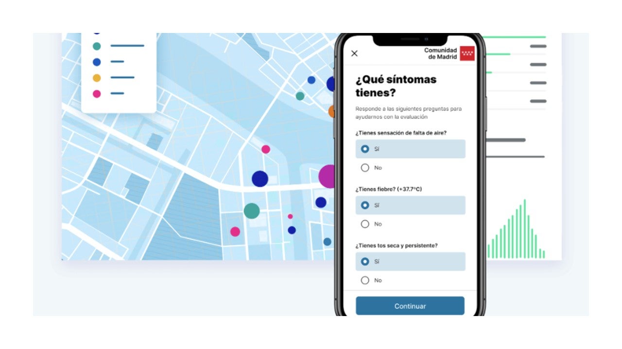
- Gathering location data at the speed required to contain the pandemic is proving challenging, but web & mobile apps like Coronamadrid are allowing governments to manage the crisis more effectively with self-diagnosis mechanisms. By tracking symptoms, you can reduce the pressure on emergency hotlines & understand the pandemic from a spatio-temporal perspective with the data gathered.
- Using COVID-19 data to fight & contain the pandemic with advanced analytics is critical to protect public health & save lives. Using spatial data through mobile & web applications will allow us to beat Coronavirus faster.
- Social Distancing Analysis
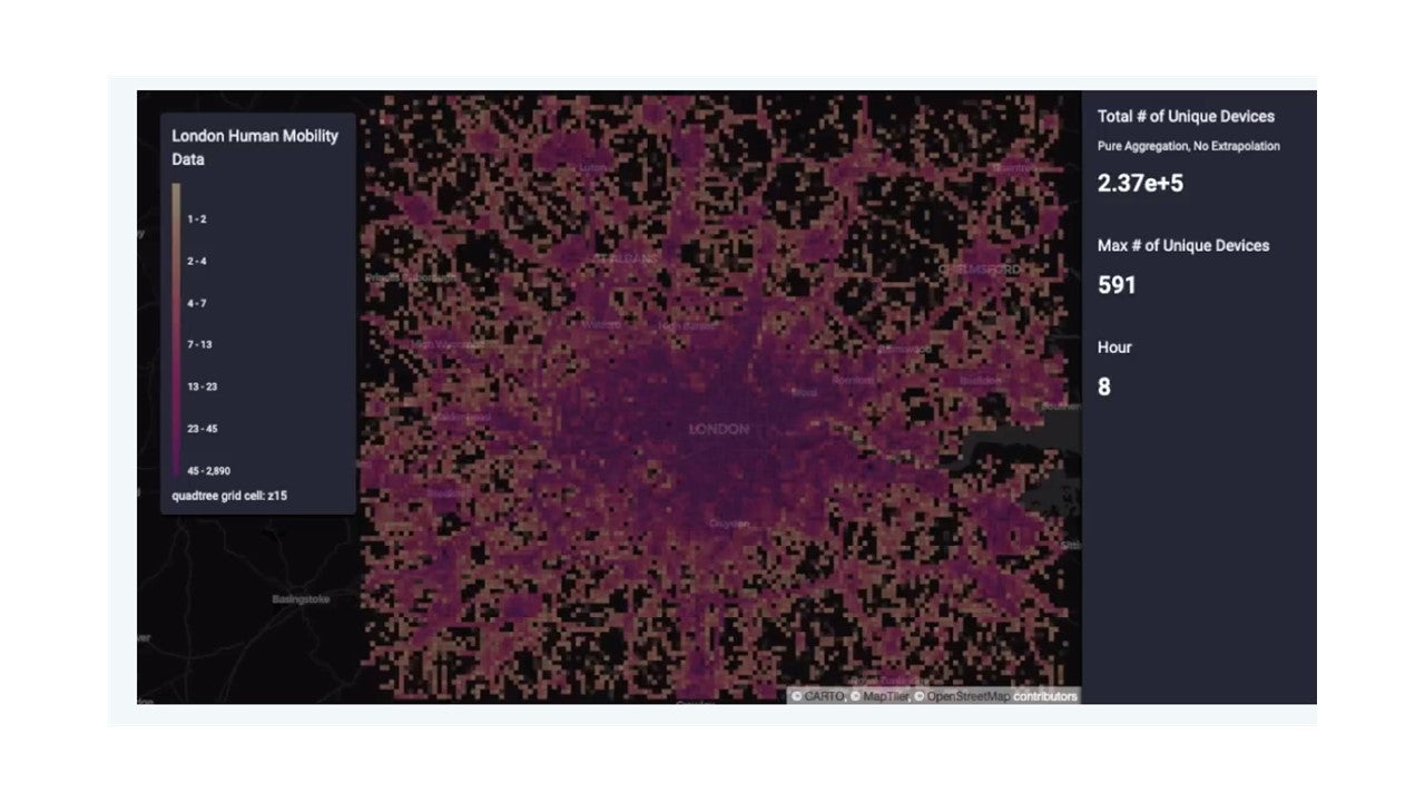
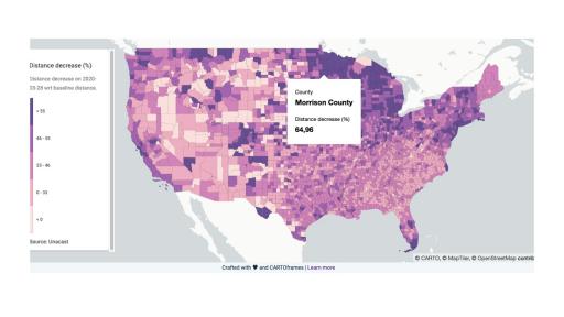
- Many countries are using social distancing strategies to decrease the transmission of the virus before moving to full lockdowns. Using spatial data on human mobility, governments can see where measures are or aren’t working using dashboards, as well as including critical POIs (hospitals, supermarkets, clinics) to understand patterns. These insights can also be used by the police for law enforcement.
- Overcrowding Analysis
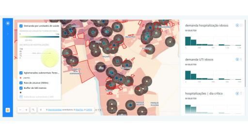
- With cities in lockdown, transport systems are experiencing a drop in demand & capacity. Alongside this there is a need for city authorities to provide essential services to health-care workers, first responders & other essential personnel. Spatial analysis can be used to determine areas at risk from overcrowding to ensure efficient movement of these individuals.
Click here to learn more about CARTO's COVID-19 Data Analytics, and CARTO's platform.
Click here to view demo of that solution. You can request a live demo through this this page.
Tool Specification
N/A
- Less than 150 institutions for COVID-19 response in 46 countries
- 50-100 for internal apps, and uncapped for public use cases
- Yearly subscription based model
- Public
- Private
- End to end services for implementation and support
- Less than 2 weeks
- Data Streams Provided by CARTO: https://carto.com/platform/location-data-streams/
- Platform > Cloud/OnPrem based on requirements. Special program for Covid Grant https://carto.com/pricing/
- Services by hour estimation: average 60$/hour
- Partners available world wide for implementation services
- No
- Yes
- Covid19 Use cases: https://carto.com/covid-19/
- Github: https://github.com/cartodb
- Grants: https://carto.com/blog/carto-free-for-fight-against-coronavirus/
- Developers: https://carto.com/developers/
- Free and open source software
- English, Spanish, Portuguese, and French
- Data standards/ Interoperability standards: CARTO is based and main contributor for PostgreSQL /PostGIS Open Source projects and data standards. https://carto.com/help/working-with-data/data-types/
- Privacy and confidentiality standards: CARTO uses industry standard physical, managerial, and technical safeguards to preserve the integrity and security of your PI. CARTO follows Californian and European Economic Area UROPEAN ECONOMIC AREA (EEA) Data Protection Rights.
- Javascript
- Rails
Rating and Comments
Multimedia


- CARTO
- Implementation partners
- Data provider
Leave a rating